Home
About us
Municipalities
Analytics
News
geo
eng
Home
About us
Municipalities
Analytics
News
contact@geologymaps.ge
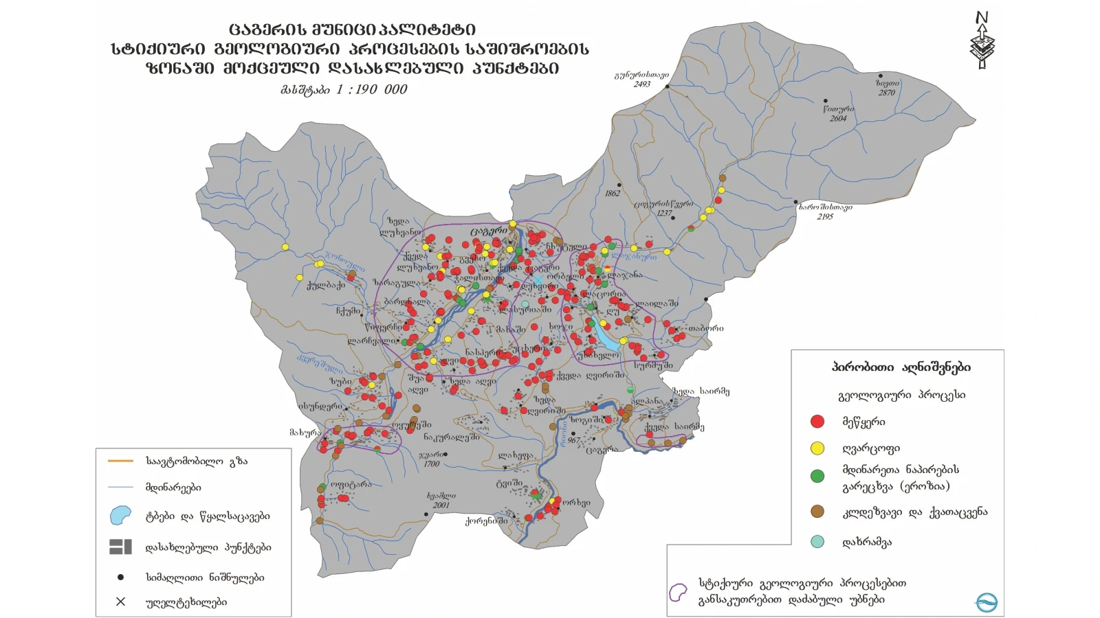
Tsageri | 22 location
Home
Municipalities
Tsageri
Geological event
Select a geological event
Abrasion (geologic)
Concave
Flood
Gullying
Landslide
Lateral erosion
Mudslide
Other
Rock avalanche
Rockfall
Washing the river bank
level of danger
Select a risk level
Very high
High
Medium
Low
N/A
Chkhuteli village, the left slope of the Tskhenitskali river
Geological event:
Landslide
level of danger:
High
The village of Kveda Tsageri, the left slope of the Tskhenitskali river
Geological event:
Landslide
level of danger:
High
Village Ghu , left slope of Lajanuri river valley
Geological event:
Landslide
level of danger:
Medium
Village Lailashi, left slope of Lajanuri river reservoir
Geological event:
Landslide
level of danger:
High
Village Surmushi, the left slope of the Khelishuri river valley, the left tributary of the Lajanuri river
Geological event:
Landslide
level of danger:
High
The village of Laskhana, the left slope of the Tskhenitskali river
Geological event:
Landslide
level of danger:
Medium
Orkhvi village, left slope of Rioni river
Geological event:
Landslide
level of danger:
High
Nasperi village, Utskerisghele river valley
Geological event:
Landslide
level of danger:
High
Village in Zeda Ghvirishi, left slope of Utskeresghele river
Geological event:
Landslide
level of danger:
High
Village Usakhelo, right slope of Lajanuri river reservoir
Geological event:
Landslide
level of danger:
High
Village Spatagori , right slope of Lajanuri river reservoir
Geological event:
Landslide
level of danger:
High
Bardnala village, the right slope of the Tskhenitskali river
Geological event:
Landslide
level of danger:
Medium
Zubi village, the right slope of the Tskhenitskali river
Geological event:
Landslide
level of danger:
High
Larchvali village, the right slope of the Tskhenitskali river gorge
Geological event:
Landslide
level of danger:
High
The village of Sanorchi, the right slope of the Utskherisghele river gorge
Geological event:
Landslide
level of danger:
High
Aghvi village, the right slope of the Tskhenitskaliriver valley
Geological event:
Landslide
level of danger:
High
Lukhvano village, the right slope of Tskhenitskali river; The left slope of Namkashuri river
Geological event:
Landslide
level of danger:
High
Lajana village, left slope of Lajanuri river valley
Geological event:
Landslide
level of danger:
High
Lukhvano-Zaragula village connecting road
Geological event:
Landslide
level of danger:
High
Kutaisi-Alpana-Mamison central highway
Geological event:
Landslide
level of danger:
Medium
Kutaisi-Alpana-Mamison central highway
Geological event:
Mudslide
level of danger:
Medium
Road connecting Okureshi-Khwamli mountain
Geological event:
Rock avalanche
level of danger:
Medium
The maps used in the project were produced by the National Environmental Agency.
.png)
.png)
.png)
.png)
.png)
.png)
.png)
.png)
.png)
.png)
.png)
.png)
.png)
.png)
.png)
.png)
.png)
.png)
.png)
.png)
.png)
.png)