Home
About us
Municipalities
Analytics
News
geo
eng
Home
About us
Municipalities
Analytics
News
contact@geologymaps.ge
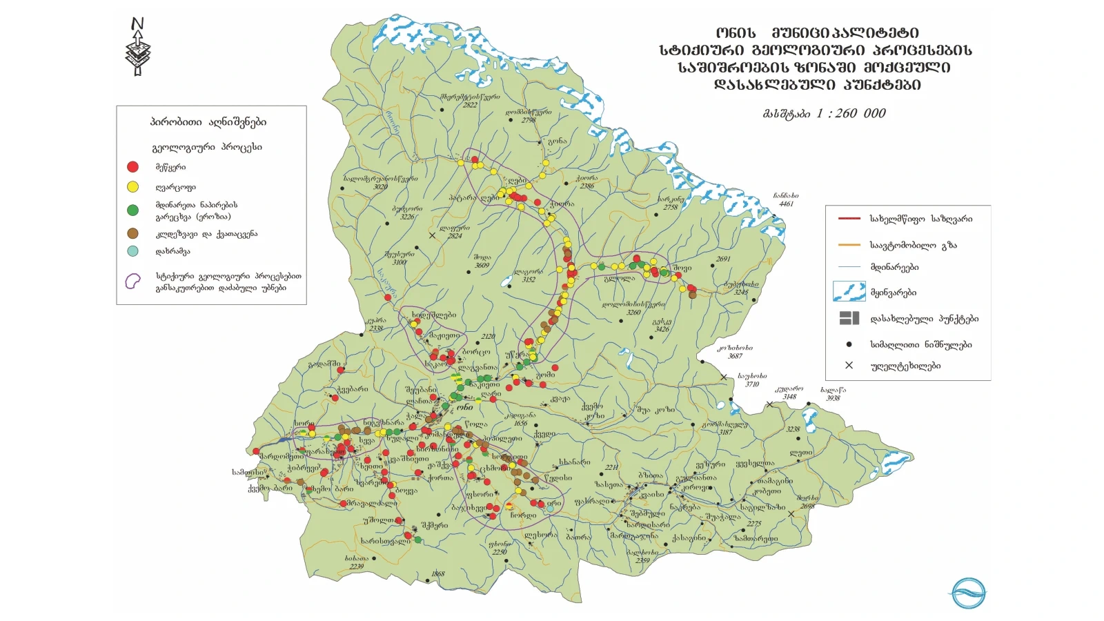
Oni | 31 location
Home
Municipalities
Oni
Geological event
Select a geological event
Abrasion (geologic)
Concave
Flood
Gullying
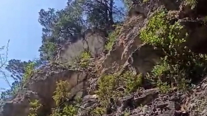
Landslide
Lateral erosion
Mudslide
Other
Rock avalanche
Rockfall
Washing the river bank
level of danger
Select a risk level
Very high
High
Medium
Low
N/A
Bajikhevi village, right tributary of Rioni river, left slope of Chale river
Geological event:
Landslide
level of danger:
High
Khideshlebi village, the valley of the left tributary of the Sakaura river, River Khideshlebi valley
Geological event:
Mudslide
level of danger:
Medium
Khideshlebi village, the valley of the left tributary of the Sakaura river, River Khideshlebi valley
Geological event:
Lateral erosion
level of danger:
Medium
Tshkmori village, right slope of the Chalistskalli River gorge and the left tributary of the Chalistskalli River
Geological event:
Landslide
level of danger:
High
Tshkmori village, right slope of the Chalistskalli River gorge and the left tributary of the Chalistskalli River
Geological event:
Mudslide
level of danger:
High
The village of Glola, the valley of the the Dgviora river, left tributary of the Chanchakha river,
Geological event:
Mudslide
level of danger:
High
Village of Utsera - Right tributaries of Rioni River, gorges of Mushuani River and Beglori River
Geological event:
Mudslide
level of danger:
High
Jichvisi village - Gomrula river gorge and right slope of Gomrula river
Geological event:
Mudslide
level of danger:
High
Jichvisi village - Gomrula river gorge and right slope of Gomrula river
Geological event:
Landslide
level of danger:
High
Farakheti village - the right slope of Cheshora river gorge
Geological event:
Landslide
level of danger:
High
Ghebi village - Latkishora valley, the right tributary of Rioni river
Geological event:
Mudslide
level of danger:
High
Ghebi village - Latkishora valley, the right tributary of Rioni river
Geological event:
Lateral erosion
level of danger:
High
The village of Khirkhonisi - the left slope of the river Rioni
Geological event:
Landslide
level of danger:
Medium
Komandeli village - the left slope of Jejori river valley
Geological event:
Landslide
level of danger:
High
The village of Ghunda - the left slope of the left tributary of the Jejori river
Geological event:
Landslide
level of danger:
Medium
Tchiora village - left slope of river Rioni
Geological event:
Landslide
level of danger:
Low
Tchiora village - left slope of river Rioni
Geological event:
Mudslide
level of danger:
Low
Oni-Shovi Highway, right bank of Rioni River
Geological event:
Landslide
level of danger:
Medium
Oni-Shovi Highway, right bank of Rioni River
Geological event:
Rock avalanche
level of danger:
Medium
Oni-Shovi Highway, right bank of Rioni River
Geological event:
Lateral erosion
level of danger:
Medium
Villages Saka-Mazhieti highway, left slope of Sakaura river valley
Geological event:
Landslide
level of danger:
High
Villages Saka-Mazhieti highway, left slope of Sakaura river valley
Geological event:
Rockfall
level of danger:
High
Kutaisi-Alpana-Mamisoni central highway
Geological event:
Mudslide
level of danger:
High
Kutaisi-Alpana-Mamisoni central highway
Geological event:
Landslide
level of danger:
Medium
Bokva village, new central road connecting Sachkhere-Oni
Geological event:
Landslide
level of danger:
Medium
Oni-Ghebi highway, the right side of the Rioni river valley
Geological event:
Mudslide
level of danger:
High
Oni-Ghebi highway, the right side of the Rioni river valley
Geological event:
Lateral erosion
level of danger:
High
Tchibrevi village, the left slope of the Murekhana River gorge
Geological event:
Landslide
level of danger:
Medium
Village Zudali, left bench of Rioni river
Geological event:
Lateral erosion
level of danger:
Medium
Village Bari
Geological event:
Landslide
level of danger:
N/A
Village Bari
Geological event:
Rockfall
level of danger:
N/A
The maps used in the project were produced by the National Environmental Agency.
.png)
.png)
.png)
.png)
.png)
.png)
.png)
.png)
.png)
.png)
.png)
.png)
.png)
.png)
.png)
.png)
.png)
.png)
.png)
.png)
.png)
.png)
.png)